Auktioner
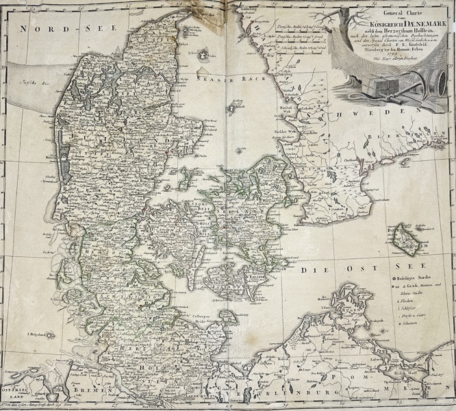
Bilder Homann Heirs – Map of the Kingdom of Denmark – Copperplate Engraving (1789)

Beskrivning
This original engraved map titled General Charte vom Königreich Dänemark was published in Nuremberg in 1789 by the Homann Heirs (Homann Erben), one of the most prominent German cartographic publishing houses of the 18th century. The map details the Kingdom of Denmark and the Duchy of Holstein, extending from the North Sea (Nord-See) to the Baltic (Die Ost-See), and includes surrounding regions of Schleswig, Jutland, Zealand, and parts of Sweden and Mecklenburg.
The map is richly annotated with towns, rivers, administrative boundaries, and roads, with subtle original hand-coloring used to distinguish territorial divisions. A decorative cartouche in the upper right corner features navigational instruments, maritime imagery, and the title, emblematic of Homann’s blend of scientific clarity and baroque embellishment.
Artist or Maker:
Homann Heirs (Homann Erben)
Dimensions:
51 cm x 57 cm
Medium:
Copperplate Engraving with Original Hand-Coloring
Date:
1789
Condition Report:
This work is in good condition overall. There may be a few minor imperfections or fox or mottled marks to be expected with age. Please review the images carefully for condition details, and feel free to contact us with any questions or for a comprehensive condition report.
Product options
Liknande objekt
Högsta bud
6 000 SEK