Auktioner
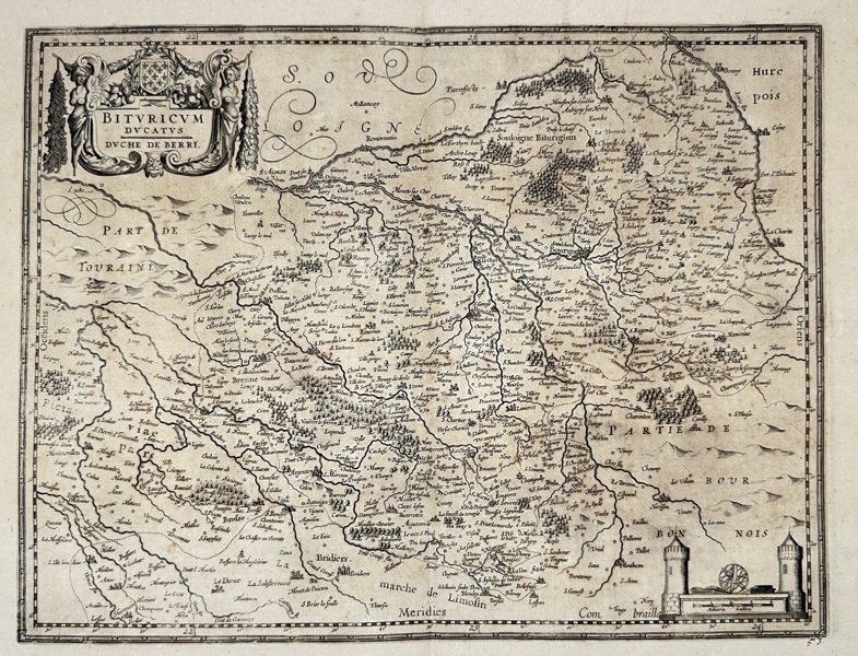
Bilder Joan Blaeu (1596–1673) – Map of the Duchy of Berry (Bituricum Ducatus / Duche de Berry) – Copperplate Engraving (17th Century)

Beskrivning
This beautifully engraved map titled Bituricum Ducatus / Duche de Berry presents the historic French province of Berry, located in central France. The map details rivers, towns, forests, and regional boundaries with fine linework and elegant typography. A richly decorated cartouche in the upper left corner, flanked by allegorical figures, adds artistic flourish to the geographical precision.
The lower right corner features a detailed architectural vignette. Issued by Joan Blaeu, one of the most celebrated cartographers of the Dutch Golden Age, this map was originally published in his monumental Atlas Maior, which set the standard for cartographic excellence in the 17th century.
Artist or Maker:
Joan Blaeu
Dimensions:
56 cm × 47 cm
Medium:
Copperplate Engraving
Date:
c. 1640s–1660s
Condition Report:
This work is in good condition overall. There may be a few minor imperfections or fox or mottled marks to be expected with age. Please review the images carefully for condition details, and feel free to contact us with any questions or for a comprehensive condition report.
Product options
Liknande objekt
Högsta bud
150 SEK