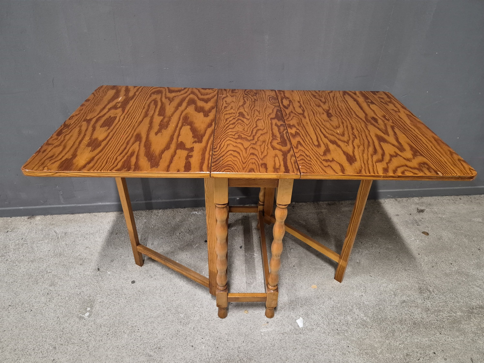
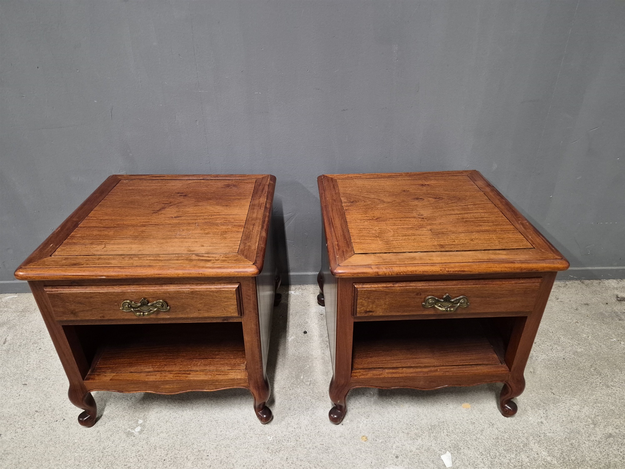
Auktioner
Bilder Nicolas De Fer (1646–1720) – Map of the Harbor of Toulon – France – Engraving (1699)


Beskrivning
"Rade de Toulon." This engraving presents a detailed hydrographic and topographical map of the harbor of Toulon on the Mediterranean coast. The composition features a central compass rose with rhumb lines extending across the water, indicating the various approaches to the port. The city itself is depicted as a fortified enclave at the head of the harbor, while the surrounding mountainous terrain is rendered in profile. Several sailing vessels are shown positioned throughout the inner and outer roadsteads, highlighting the strategic naval importance of the location. This work was published in Paris by De Fer, whose workshop was located on the Quai de l'Horloge at the sign of the Sphere Royale.
Nicolas De Fer was a prolific French cartographer, engraver, and publisher who served as the official geographer to both the French and Spanish royal courts. He was renowned for his ability to produce maps that were as much works of art as they were scientific documents, often prioritizing decorative elegance and current events over absolute geographical precision. Throughout his career, he published over six hundred maps and numerous atlases, documenting the territorial expansions and military campaigns of King Louis XIV. His workshop in Paris became a center for the dissemination of geographical knowledge, making his maps highly influential among the European aristocracy and military elite. De Fer's legacy is defined by his extensive documentation of the shifting borders and strategic ports of the early modern world.
Artist or Maker: Nicolas De Fer.
Dimensions: Approximately 31 cm x 23 cm.
Medium: Engraving.
Date: 1699.
Condition Report:
This work is in good condition overall. There may be a few minor imperfections or fox or mottled marks to be expected with age. Please review the images carefully for condition details, and feel free to contact us with any questions or for a comprehensive condition report.